 Surrounding Towns
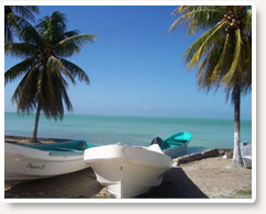
Sarteneja Sarteneja, located on the northern tip of the Sarteneja Peninsula (also called the Shipstern Peninsula) has remained populated and prosperous for thousands of years. Sarteneja village's Mayan name translates to "water between the rocks," referring to a massive piece of stone within the village. Although the village itself has been rebuilt several times, this giant slab has persevered and served as a freshwater source throughout the area's geological history. Today, more than ninety percent of Sarteneja's 1,500 residents earn their income from the sea - a statistic that has earned Sarteneja a reputation for supporting the country's most skilled fishing community. Click here for more information about Sarteneja.
Surrounding Towns
Sarteneja Sarteneja, located on the northern tip of the Sarteneja Peninsula (also called the Shipstern Peninsula) has remained populated and prosperous for thousands of years. Sarteneja village's Mayan name translates to "water between the rocks," referring to a massive piece of stone within the village. Although the village itself has been rebuilt several times, this giant slab has persevered and served as a freshwater source throughout the area's geological history. Today, more than ninety percent of Sarteneja's 1,500 residents earn their income from the sea - a statistic that has earned Sarteneja a reputation for supporting the country's most skilled fishing community. Click here for more information about Sarteneja.
Chunox
Chunox is an isolated town in the Corozal District of the nation of Belize. Chunox is located at 18N, 88W, at an altitude of 3 meters above sea level. According to the 2000 census, Chunox had a population of 1,143 people.
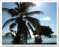
Copper Bank Copper Bank, population 500, is a charming little fishing village on Laguna Seca, in the Corozal District, so called because it has occasionally dried up to a channel. In fact, today, it is a beautiful lake, full of fish, and a gateway to the waters of the Caribbean and Bacalar Chico.
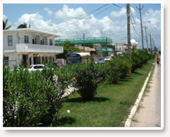
Corozal and Orange Walk Districts Corozal and Orange Walk Districts are in Northern Belize. Corozol Town, population of about 10,000, which is in Corozol District, is minutes from the City of Chetumal in Mexico with a population around 130,000. Orange Walk Town, population 12,000, is farther south, in Orange Walk District. Travelers can explore the jungle in the south and the Mayan world from these locations, including the important Mayan archaeological site of Lamanai.
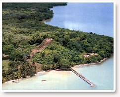 Cerros Cerros is a Maya archaeological site strategically located on a peninsula at the mouth of the New River in northern Belize near Caribbean Blue. The Cerros Maya sprawls over 53 acres atop a hill overlooking Chetumal Bay. This was an important coastal trading center a long time ago. As such, the site had access to and served as an intermediary link between the coastal trade route that circumnavigated the Yucatán Peninsula and inland communities. The inhabitants of Cerros constructed an extensive canal system and utilized raised-field agriculture.
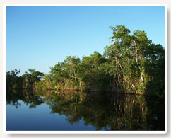
Cerros provides a beautiful panorama of the surrounding region. The nearby New River supports a variety of wildlife including water birds, crocodiles and manatee.
Cerros Cerros is a Maya archaeological site strategically located on a peninsula at the mouth of the New River in northern Belize near Caribbean Blue. The Cerros Maya sprawls over 53 acres atop a hill overlooking Chetumal Bay. This was an important coastal trading center a long time ago. As such, the site had access to and served as an intermediary link between the coastal trade route that circumnavigated the Yucatán Peninsula and inland communities. The inhabitants of Cerros constructed an extensive canal system and utilized raised-field agriculture.
Cerros provides a beautiful panorama of the surrounding region. The nearby New River supports a variety of wildlife including water birds, crocodiles and manatee.